- Addiewell No.1 pit
- Addiewell No.1 mine
- Addiewell No.2 pit
- Addiewell No.2 mine
- Addiewell No.3 pit
- Addiewell No.3 mine
- Addiewell No.4 pit
- Addiewell No.5 pit
- Addiewell No.6 pit
- Addiewell No.18 mine
- Albyn mine
- Alderstone No.43 mine
- Baads No.9 pit
- Baads No.15 pit
- Baads No.17 mine
- Baads No.22 pit
- Baads No.23 pit
- Baads No.42 mine
- Boghall No.1 pit
- Boghall No.2 coal pit
- Boghall No.3 pit
- Boghall No.4 pit
- Boghall "Raeburn" mine
- Breichdykes pits
- Breich No. 1 & 2 pits
- Burngrange No. 1 & 2 pits
- Burngrange No. 39 mine
- Burntisland No.1 mine
- Burntisland No.2 mine
- Burntisland No.3 mine
- Burntisland No.4 mine
- Carledubs mine
- Champfleurie mine
- Cobbinshaw No.1 & 2 mines
- Cobbinshaw No.5 mine
- Cobbinshaw South No. 1 pit
- Cobbinshaw South No.28 mine
- Cobbinshaw South No.3 mine
- Cobbinshaw (West Calder Oil) pit
- Cousland No.1 mine
- Cousland No.2 mine
- Crossgreen No.1, 2, & 3 mines
- Cuthill No.24 coal mine
- Dalmeny No.1 pit
- Dalmeny No.2 pit
- Dalmeny No.3 pit
- Dalmeny Railway No.1 & 2 mines
- Deans (Caputhall) mine
- Deans No.1 mine
- Deans No.2 mine
- Deans No.3 mine
- Deans No.3 mine & quarry (W.L.O.C.)
- Deans No.4 mine
- Deans No.4 pit
- Deans No.5 mine
- Deans No.6 mine
- Deans No.7 mine
- Drumcrosshall No1. & No.2 mines
- Drumshoreland Muir pit
- Duddingston No. 1 & 2 mines
- Duddingston No.3 mine & quarry
- Dunnet or Sandholes mine
- Dunnet's mine, East Hermand
- Easter Breich coal mine
- Easter Breich No.1 & 2 pits
- Fivestanks mine
- Fivestanks; unidentified mine
- Forkneuk No.1 & 2 pits
- Forkneuk No.38 mine
- Forkneuk No.9 & 10 pits
- Fraser pit
- Gavieside No.1 pit
- Gavieside No.2 pit
- Gavieside No.3 pit
- Gavieside No.40 mine
- Grange No.1 & 2 pits
- Grange No.3 pit
- Greendykes North mine
- Greendykes South mine
- Greenfield No.1 pit
- Greenfield No.3 mine
- Hartwood mine & coal pit
- Hayscraigs mines and quarries
- Hermand mine
- Hermand (Murray's pool) mine
- Hermand No.5 pit
- Hermand No.6 mine
- Hillend coal pit
- Holmes mine
- Hopetoun No.35 pit
- Hopetoun No.4 mine
- Hopetoun No.1 pit
- Hopetoun No.2 pit
- Hopetoun No.3 mine
- Hopetoun No.41 (Fawnspark) mine
- Hopetoun No.44 mine
- Hopetoun No.5 pit
- Hopetoun No.6 (Glendevon) mines
- Hut mines and quarry
- Ingliston No.33 pit
- Ingliston No.36 & 37 pits
- Lawhead No.1 mine
- Limefield No.32 mine
- Livingston quarries
- Mid Breich No.2 mine
- Mid Breich No.3 pit
- Mid Breich No.4 pit
- Mortonhall No.10 mine
- Mortonhall No.9 mine
- Muirhall No.16 coal mine
- Muirhall No.19 coal pit
- Newbigging No.1 & 2 mines
- Newfarm No.3 & 4 mines
- Newliston No.29 mine
- North Cobbinshaw mine
- Oakbank: Calder wood mine
- Oakbank No.1 & 2 pits
- Ochiltree Colliery - north
- Ochiltree Colliery - south
- Ochiltree No.2 mine
- Ochiltree No.3 mine
- Ochiltree No.5 mine
- Ochiltree No.6 mine
- Pentland No.1 & 2 mines
- Philpstoun No. 1 mine
- Philpstoun No. 1 (Whitequarries) mine
- Philpstoun No. 2 mine
- Philpstoun No. 3 mine
- Philpstoun No. 4 (grey) mine & quarry
- Philpstoun No. 4 mine
- Philpstoun No. 5 mine
- Philpstoun No. 6 (Whitequarries) mine
- Philpstoun No.7 mine
- Polbeth No. 8 pit
- Polbeth No.10 pit
- Polbeth No. 11 pit
- Polbeth No. 20 mine
- Polbeth No. 21 mine
- Polbeth No. 26 mine
- Polbeth No. 27 mine
- Polbeth No. 31 mine
- Polbeth No. 7 & 7½ pits
- Pumpherston No.1 mine
- Pumpherston No.2 mine
- Pumpherston No.3 mine
- Pumpherston No.4 mine
- Pumpherston No.5 mine
- Pumpherston No.6 mine
- Pyothall No.5 pit
- Redhouse No.1 coal mine
- Roman Camp (Cawburn) mine
- Roman Camp No.1 mine
- Roman Camp No.3 mine
- Roman Camp No.4 pit
- Roman Camp No.5 mine
- Roman Camp No.6 mine
- Roman Camp No.7 mine
- Roman Camp (north) No.2 mine
- Roman Camp (south) No.2 mine
- Rosshill No.1 & 2 mines
- Seafield coal mine
- Seafield No.1 mine
- Seafield No.3 mine
- Stankards No.1 pit
- Stankards No.45 mine
- Stewartfield No.1 mine
- Stewartfield No.1 pit
- Stewartfield No.2 mine
- Stewartfield No.2 pit
- Stewartfield No.3 pit
- Stewartfield No.4 pit
- Straiton No.1 & 2 mines
- Straiton No.3 pit & No.3 mine
- Straiton No.4 mine
- Straiton No.8 mine
- Strathbrock collieries
- Tarbrax No.1 pit
- Tarbrax No.2 pit
- Tottleywells No.1 mine
- Viewfield coal pit
- Viewfield No. 4 & 5 pits
- Westwood No.12 pit
- Westwood No.1 & 2 pits
- Westwood No.13 pit
- Westwood No.30 pit
- Woolfords colliery
Hopetoun No.44 mine
Parish:
Kirkliston, Linlithgowshire and Midlothian
Local authority:
West Lothian
Seams worked:
Broxburn Shale
Opened:
1909
Closed:
1916
Current status of site:
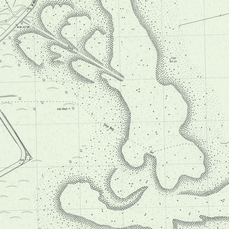
Buried beneath Greendykes bing
Regional overview:
Inclined adit
Serving Hopetoun Oil Works
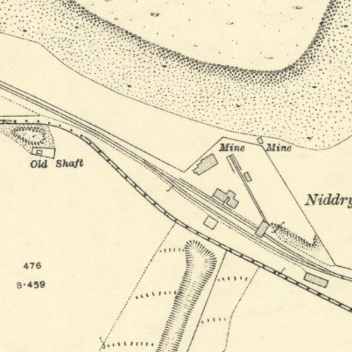
A short-lived mine, also known as "Niddry Mine", exploiting Broxburn Shales from beneath Hopetoun Oil Works bing.
Shale-field: Broxburn district.
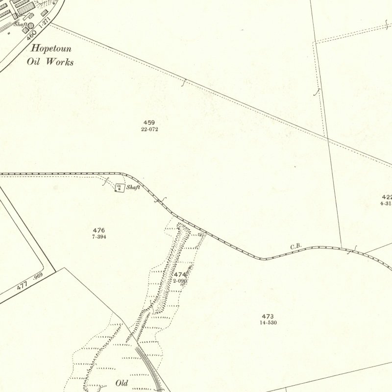
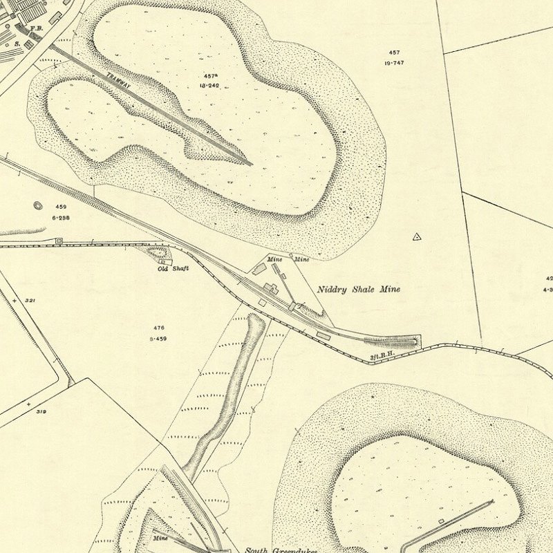
Mapped by the Ordnance Survey of c.1916, showing No. 44 Mine in production and Hopetoun Oil Works bing encroaching from the north.
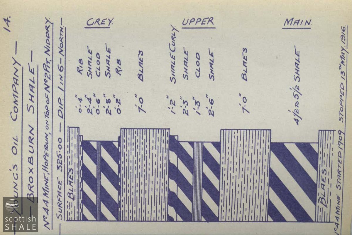
From "Sections of Shale Seams", a notebook by Robert Crichton. BP Archive 183734
Recent images
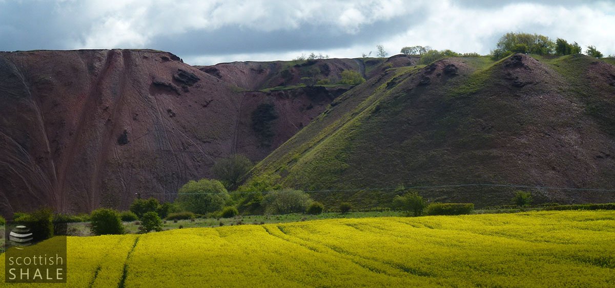
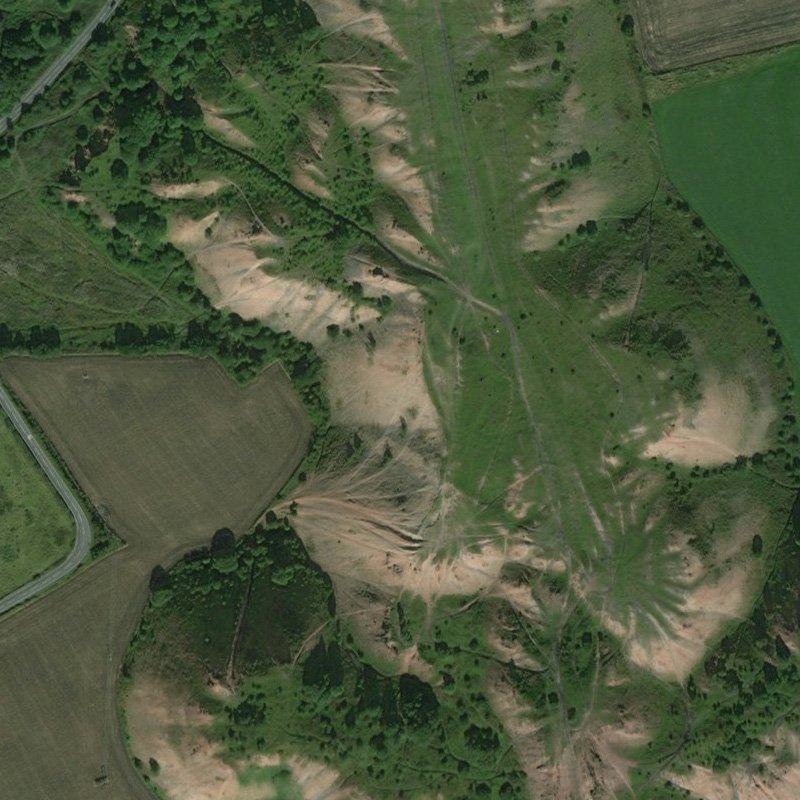
View towards the site of No. 44 Mine, now submerged between the bings in the centre of this image. Looking south east. May 2012.
- Coal Authority Mine Abandonment Catalogue No. 6612, showing workings in the Broxburn Upper, Main and Grey Shales from Hopetoun No.44 Mine, abandoned in 1916.
- Agreement No. 449. Licence under the Explosives Act for a gunpowder store at No.44 mine, Hopetoun, October 1909. Young's Paraffin Light & Mineral Oil Company Ltd; Inventory of Leases, Agreements &c. BP Archive 215854


