Plans
Maps, plans, architectural and technical drawings
| Image | Code | Title | Type | Description |
|---|---|---|---|---|
|
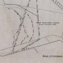
LVSAV1984.063 | Plan - Niddry Castle bing, 1942 | File Record | 25" Plan of Niddry Castle bing, dated 1942, on linen |
|
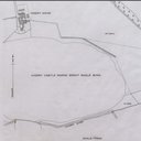
LVSAV1984.064 | Plan - Niddry Castle bing, 1962 | File Record | 1/2500 Plan of Niddry Castle bing, dated 1962, on linen |
|
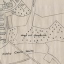
LVSAV1984.065 | Plan - Niddry Castle bing | File Record | 25" Plan of Niddry Castle bing, showing Winchburgh, Niddry Mains, etc, no date |
|
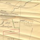
LVSAV1984.067 | Plan - land at Roman Camp No 6 mine | File Record | 1/1250 plan, Cawburn Chemical Works, Roman Camp No 6 mine, Earl of Buchan, undated |

|
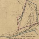
LVSAV1984.068 | Plan- damaged ground at Greendykes | File Record | 1/2500 plan showing damaged ground, Greendykes Farm, Albyn Cottages, Earl of Buchan |
|
LVSAV1984.069 | Plan - Niddry Castle bing, 1961 | File Record | Office copy, on linen, 25":1 mile plan showing Niddry Castle bing 1943-1961. |
|
|
LVSAV1984.085 | Plan - Addiewell Village and works | File Record | 1/2500 OS plan (1904) of Addiewell village and works with hand coloured pipe route |

|
LVSAV1991.038 | Plan - Green Shale Haulage, Addiewell Works | File Record | Paper blueprint titled "Green Shale Haulage, Addiewell Works, proposed alterations to incline " dated 27/11/1944, stamped Scottish Oils. |
|
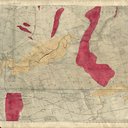
LVSAV1991.041 | Map - OS Linlithgowshire/Edinburgh | File Record | OS Linlithgowshire/Edinburgh composite sheet 6" to 1 mile.1856, with hand-coloured and hand written geological features, also borehole annotations. (Ecclesmachan to Gorgie), shows Almondhill Paraffin Oil … |
|
|
LVSAV1991.042 | Map - OS Linlithgowshire/Edinburgh | File Record | OS Linlithgowshire/Edinburgh composite sheet 25" to 1 mile, 1896, with hand-coloured watercourses on linen. Also location of trial pits and boreholes around Seafield Oil Works, … |